
They say a picture is worth a thousand words. I can’t think of a better way to convey the intensity of a tropical cyclone than graphs of pressure and wind velocity vs time from one of NOAA’s permanent weather buoys located in the offshore Gulf of Mexico.
This particular station, #42002, recorded the passage of the eyewall and the eye of Hurricane Delta at about 7:00 pm CDT last evening.
Barometric Pressure
A tropical cyclone is an extreme low-pressure event. The graph below shows just how intense that “vacuum” is: in this case nearly two inches of mercury below normal. It’s not just the pressure reading, but the extreme pressure gradient of the eyewall that leads to high winds and high seas.

Wind speed and gusts
These graphs depict the extreme swings in wind speed experienced when passing from the eyewall into the eye itself. With the storm’s passage, wind direction will also shift, from easterly, to dead calm, to westerly as the counter-clockwise rotation of the storm passes over. At this station, sustained winds were 65 knots with gusts over 85. With the passage of the eye, wind velocity increased back to 55 knots.


Station 42002 is located just below center on the map below. Not all of the stations have active data.
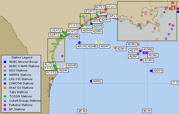

NOAA’s buoy data for the Western Gulf is available here: https://www.ndbc.noaa.gov/maps/WestGulf.shtml
