NASA Nighttime Photos Show Drilling Rig Hot Spots

Nasa earth_01

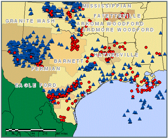
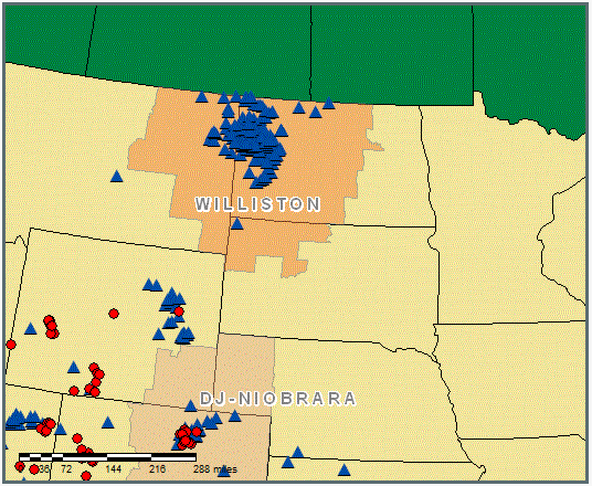
Large cities and major interstate highways are readily identifiable. But what’s going on in South Texas, West Texas and North Dakota?

12-12-2012 9-32-52 AM

Baker-Hughes, a major service company, has an online rig locator. In the detail maps below, each blue triangle represents an active rig targeting oil; red circles represent rigs targeting gas.

12-12-2012 12-14-23 PM

12-12-2012 12-15-45 PM

Advertisement
This entry was posted in Energy and tagged , , , , . Bookmark the permalink.

1 Response to NASA Nighttime Photos Show Drilling Rig Hot Spots

Leave a Reply

Fill in your details below or click an icon to log in:

WordPress.com Logo

You are commenting using your WordPress.com account. Log Out /  Change )

Facebook photo

You are commenting using your Facebook account. Log Out /  Change )

Connecting to %s